Flickr Photos


 The Blue Dogs
- An error has occurred; the feed is probably down. Try again later.
The Adirondack Almanac
- An error has occurred; the feed is probably down. Try again later.
Hiking, Camping, and Exploring in the Adirondacks

When the day starts off looking like it does in this photo, you know you’re in for a great hike. Although a big storm had just passed by, the wind seemed pretty quiet, and now there should be lots of snow on top. It’s Christmas break time, so the parking lot was already getting crowded. It’s always nice when it’s not to busy, but today, the people I met along the way, made for a really great hike! I always seem to meet some of the nicest folks, out on my hikes, and today would be no different. I guess the combination of atmosphere and shared interests doesn’t hurt.
After signing in at the trail head, it was time to put on the snowshoes. With more than 8 inches of snow, as there was today, skis or snowshoes are a requirement. Not only that, it wasn’t long before you really needed them, as the trail had more even more snow, and ice, not far from the start. ") The hike up Algonquin is fairly short, as far as high peaks are concerned, but it’s also very steep. You go up almost 3000 ft. in a relatively short time, so be prepared! I passed a few groups on the way up, but otherwise, it was pretty quiet on the trail. By the time I reached the junction for Wright Peak, I was ready to add a layer, to prepare for the top. The sun was just beginning to rise over Algonquin, and I could feel the day warming a bit. I met up with a wonderful couple, whom I would be following for most of the day. The final stretch was mostly deep, packed snow. There wasn’t much ice, and if you stepped off the trail a little, you went into snow above your knees. Near the peak of Algonquin, the trail itself was hard to see, as the wind blows the snow around. The rock cairns, though, are easy to spot, and almost any way you go, as long as it’s up, you’ll find the peak! The winds weren’t too bad, around 20 mph or so. The last time I was up here, in the winter, the winds were over 35 mph, and you needed goggles and a mask. The best part was how clear the day was. Picture time here we come.
The hike up Algonquin is fairly short, as far as high peaks are concerned, but it’s also very steep. You go up almost 3000 ft. in a relatively short time, so be prepared! I passed a few groups on the way up, but otherwise, it was pretty quiet on the trail. By the time I reached the junction for Wright Peak, I was ready to add a layer, to prepare for the top. The sun was just beginning to rise over Algonquin, and I could feel the day warming a bit. I met up with a wonderful couple, whom I would be following for most of the day. The final stretch was mostly deep, packed snow. There wasn’t much ice, and if you stepped off the trail a little, you went into snow above your knees. Near the peak of Algonquin, the trail itself was hard to see, as the wind blows the snow around. The rock cairns, though, are easy to spot, and almost any way you go, as long as it’s up, you’ll find the peak! The winds weren’t too bad, around 20 mph or so. The last time I was up here, in the winter, the winds were over 35 mph, and you needed goggles and a mask. The best part was how clear the day was. Picture time here we come.") You don’t often get weather like this. I’m not sure exactly, but I would guess there are around 20 days of the winter that are this nice (? < 30%) at the most.
You don’t often get weather like this. I’m not sure exactly, but I would guess there are around 20 days of the winter that are this nice (? < 30%) at the most.
The trail down the backside of Algonquin took us out of the wind, and with the sun shining, it felt quite a bit warmer. The trail up Boundary wasn’t bad, but there were a few spots where you could go in three or four different directions. They all ended up back on the main trail, and the worst ones were just plain deep snow, complete with spruce traps and all.
I stopped on Boundary for a few more pictures, and to talk with a few people I ran into. The wind picked up again, and gave good reason to move on to Iroquois. The trail again split off, like before, but it was easy to spot the false paths. The final destination, Iroquois, overlooks Flowed Lands, and also reveals a nice view of Marshall, to the south. Another perfect view. There were some low clouds hanging over the valleys that provided some nice pictures, off in the distance.
")
The trip back to Boundary went quick, and a bunch of us stopped at the trail junction, going down to Colden, for lunch, and a few laughs. It’s a perfect place to stop, where it’s out of the wind, protected by the surrounding peaks. The climb back up Algonquin seemed a little longer than the trip down, but that’s always seems to be the case. One last stop for a nice shot of Colden, looking off to the east, and a chance to take in one of the nicest winter days I can remember.
")
Catch ya later!
You wouldn’t really know it by looking out my window, but Winter has arrived. Of course, over the last few weeks, the snow has really been piling up in the mountains. As I set out for the first hike of winter, I wasn’t quite sure where I wanted to go. By the time I reached Keene, though, I had picked Whiteface as my destination. I headed up Rt. 9N to 86, and up towards the Memorial Highway. Then a little less than a mile up 431, turn left on Reservoir Rd. There’s a little parking lot there, with enough room for 3 or 4 cars. Today the lot was empty.  There are a few other ways to climb Whiteface, but if you’re going to climb Ester also, this is one of the best. Actually, all though I’ve never gone up that way, there is a slightly shorter route just up the road (431) at the Science Center. From the sign on the trail, at the junction, it looks like it’s almost a mile shorter. It isn’t long before the trail gets really steep. This area was originally a ski slope (Marble Mountain) which explains the steepness. Near the top of Marble, around 2.2 miles, is the junction for the other trail I mentioned (to the Science Center), clearly marked with a big sign with the mileage. The trail continues to climb up to the ridge, around the southeast side of the approach to Ester. You can’t miss the turn to Ester. There’s a sign pointing the way, indicating the unmarked trail. The trail is in pretty good shape, and easy to follow. It’s 1.3 miles to the summit of Ester.
 ") When I got there, I wasn’t quite sure I was at the peak, until I spotted the little yellow sign, marking the top, buried in the snowy tree tops. After backtracking to the main trail, I headed towards Whiteface. The trail was in good shape until I reached the intersection with the Memorial Highway. The drifts near the top were up to my waist in spots, and it made for some slow progress. The rest of the way, visibility was low, as it was overcast, and getting late in the day. The winds weren’t too bad, though, only 20 or 30 mph. I took a few pictures at the top, and looked around at some of the buildings. It was now around 3:00, and getting dark, so I readied for the return trip. I didn’t need the headlamp until I reached the summit of Marble. As I headed down the final stretch, I swear I heard Christmas music echoing through the hills! I must be near the North Pole.
When I got there, I wasn’t quite sure I was at the peak, until I spotted the little yellow sign, marking the top, buried in the snowy tree tops. After backtracking to the main trail, I headed towards Whiteface. The trail was in good shape until I reached the intersection with the Memorial Highway. The drifts near the top were up to my waist in spots, and it made for some slow progress. The rest of the way, visibility was low, as it was overcast, and getting late in the day. The winds weren’t too bad, though, only 20 or 30 mph. I took a few pictures at the top, and looked around at some of the buildings. It was now around 3:00, and getting dark, so I readied for the return trip. I didn’t need the headlamp until I reached the summit of Marble. As I headed down the final stretch, I swear I heard Christmas music echoing through the hills! I must be near the North Pole.
")
")
Catch ya later!
It’s been quite a while since I’ve hiked into the Ausable Club area. The weather was a bit overcast, but there were a few breaks in the clouds. Passing the golf course, off to my right, ") Giant looked ominous and snowy, with its peak in the clouds. As I stopped to sign in, I expected one of the rangers to come out, as they usually do. This morning, though, they let me pass without the usual interrogation. The trip up the road passed quickly, and I stopped almost at the end of the road to prepare for the trail. By this time, there was around a foot of fresh snow. I also noticed that no one had gone this way, at least since the last snowfall. It looks like I’d be doing a little trail breaking. By the time I neared the junction, between Sawtooth, and Gothics, the snow was around 1.5 to 2 feet deep. I stopped at the junction for a breather, and some food. I was originally going to grab both Sawtooth, and Pyramid, but the combination of time, and trail breaking, I decided to skip Pyramid. Pyramid is a beautiful spot for pictures, so with the weather now mostly overcast, I wouldn’t be missing a great photo session.
Giant looked ominous and snowy, with its peak in the clouds. As I stopped to sign in, I expected one of the rangers to come out, as they usually do. This morning, though, they let me pass without the usual interrogation. The trip up the road passed quickly, and I stopped almost at the end of the road to prepare for the trail. By this time, there was around a foot of fresh snow. I also noticed that no one had gone this way, at least since the last snowfall. It looks like I’d be doing a little trail breaking. By the time I neared the junction, between Sawtooth, and Gothics, the snow was around 1.5 to 2 feet deep. I stopped at the junction for a breather, and some food. I was originally going to grab both Sawtooth, and Pyramid, but the combination of time, and trail breaking, I decided to skip Pyramid. Pyramid is a beautiful spot for pictures, so with the weather now mostly overcast, I wouldn’t be missing a great photo session.
")
")
The last 1/2 mile of trail, up Sawtooth, is tough going. The snow was really deep, unpacked powder. There was very little base for me to get a bite with my ice axe. And most of all, it gets pretty steep in spots. It took a while for me to scramble my way up to the top. As soon as I reached the summit, the sun broke through just enough for me to get a few pictures of the south side of Gothics.
")
Going back down, I ended up doing a little sliding on my rear! Grabbing the trees on the side of the trail, and with some help from my axe, the rest of steep stuff was pretty easy. By the time I neared the lake, I had to use my headlamp. That last 3+ miles always seems to take forever, after a day of climbing.
")
")
Catch Ya Later!
")
Coldest morning yet, up here. Single digits at best! Wasn’t long, though, before I was taking some layers off. I’ve had trouble, in the past, with cold feet. I realized that my summer sock setup, with a light liner, and a hiking sock over that, was no good for winter. The inner liner was wicking moisture off, which was OK, but that process also makes my feet colder (the evaporative process, OK for summer). So now I use one thick sock, and it’s working great. It seems as though the weather up here is almost always cloudy in the winter, and today was no different! I keep saying this, but the snow just gets deeper and deeper, which is OK by me! ") I needed microspikes right away, due to a thick icy base layer. It actually wasn’t until the third Brother that I really needed my snow shoes. After that, there were drifts, in spots, over two feet deep. This is the fourth time I’ve climbed Big Slide, and every time I say “Whoever measured the distance to this peak is way off!”. It feels more like 5 or 6 miles, and not 4. Maybe I’m just getting old. The last 1/2 mile is as steep as ever, and I probably should have changed back to crampons. Also, my ice axe would have come in handy, instead it was sitting in my trunk. I just did the usual scramble and crawl up the mountain trick! Works every time. There was at least 18 inches of snow, and ice underneath. As I neared the top, I cut over to look at the slide. It’s really impressive when covered with ice and snow, and the wind whips around.
I needed microspikes right away, due to a thick icy base layer. It actually wasn’t until the third Brother that I really needed my snow shoes. After that, there were drifts, in spots, over two feet deep. This is the fourth time I’ve climbed Big Slide, and every time I say “Whoever measured the distance to this peak is way off!”. It feels more like 5 or 6 miles, and not 4. Maybe I’m just getting old. The last 1/2 mile is as steep as ever, and I probably should have changed back to crampons. Also, my ice axe would have come in handy, instead it was sitting in my trunk. I just did the usual scramble and crawl up the mountain trick! Works every time. There was at least 18 inches of snow, and ice underneath. As I neared the top, I cut over to look at the slide. It’s really impressive when covered with ice and snow, and the wind whips around.") There wasn’t much to see, at the top, as by now, the weather was changing for the worse. I started back down, sliding on my butt a few times! Wasn’t as bad going down, as up. On the way back, I was surprised to meet a fairly large group, coming up. I was surprised, in part, because it was getting pretty late, and looked like it would be dark in an hour or two. As it was, I ended up needing my headlamp as soon as I reached the Brothers. This time of the year you really need to start out a lot earlier to beat the darkness. Oh well, maybe next time!
There wasn’t much to see, at the top, as by now, the weather was changing for the worse. I started back down, sliding on my butt a few times! Wasn’t as bad going down, as up. On the way back, I was surprised to meet a fairly large group, coming up. I was surprised, in part, because it was getting pretty late, and looked like it would be dark in an hour or two. As it was, I ended up needing my headlamp as soon as I reached the Brothers. This time of the year you really need to start out a lot earlier to beat the darkness. Oh well, maybe next time!
Catch ya later

Well, it really is starting to look a lot different out here. As my fourth week of training (getting ready for a few winter peaks!) continues , I have found my way back to Marcy Dam. In part, I’ve come here in support of the search for Wesley Wamsganz. Wes has now been missing for more than a week. From what I’ve heard, every trail and lean-to in the High Peaks region, and more, have been searched. The search will now be scaled back. The Rangers will keep looking, on their regular patrols, and everyone else will keep Wes in mind as they traverse the woods. There’s over 6 inches of snow up till Marcy Dam, and the ice there is now frozen over.") As I head up past the dam, and up the trail to Colden, it’s more like a foot of snow! I see lots of ribbons on the trees that were used to mark the recent grid searches. On one of my breaks, along the way, I spotted what looked like a large squirrel. As he came towards me, though, I realized it wasn’t a squirrel, but more like a weasel, or perhaps an ermine. I’ve never seen one of these out here, and it’s great to be able to catch a glimpse of some of the varied critters that inhabit these woods. I stopped at Lake Arnold, just to scout around, and also, take a few pictures. The weather was warming up, and there was a mist that was floating over Colden. From Lake Arnold on, the trail was icy, so I put on the crampons. It seems like every time I climb Colden, the skies are clear a the bottom, and it clouds up when I get to the top, and today was no different!
As I head up past the dam, and up the trail to Colden, it’s more like a foot of snow! I see lots of ribbons on the trees that were used to mark the recent grid searches. On one of my breaks, along the way, I spotted what looked like a large squirrel. As he came towards me, though, I realized it wasn’t a squirrel, but more like a weasel, or perhaps an ermine. I’ve never seen one of these out here, and it’s great to be able to catch a glimpse of some of the varied critters that inhabit these woods. I stopped at Lake Arnold, just to scout around, and also, take a few pictures. The weather was warming up, and there was a mist that was floating over Colden. From Lake Arnold on, the trail was icy, so I put on the crampons. It seems like every time I climb Colden, the skies are clear a the bottom, and it clouds up when I get to the top, and today was no different! ") Actually, it didn’t turn out to be too bad at the top, especially for this time of the year! I had the usual PBJ at the top, and took some pictures, and looked around a little bit. Every once in a while, a helicopter would fly over, real low, as this was one of the few days they’ve been able to safely fly and search. Back down on the main trail, I ran into a few people, around the area Wesley was last seen. When I checked out, I saw that Wes’s dad was still out there keeping the search going. We will all say a prayer for Wes and his family.
Actually, it didn’t turn out to be too bad at the top, especially for this time of the year! I had the usual PBJ at the top, and took some pictures, and looked around a little bit. Every once in a while, a helicopter would fly over, real low, as this was one of the few days they’ve been able to safely fly and search. Back down on the main trail, I ran into a few people, around the area Wesley was last seen. When I checked out, I saw that Wes’s dad was still out there keeping the search going. We will all say a prayer for Wes and his family.
")
")
")
")
Starting week 3 off with a hike from Upper Works. I got off to a late start, but made good time up the Northway. I stopped to eat a PBJ sandwich at the bridge going over the Calamity brook. Ran in to a group of “veteran” hikers who were on their way back. They had a few good trail stories, and filled me in on the conditions – a couple of inches of snow, some ice, and little more of each up any of the peaks. Actually, the trail ended up icier than I expected. I made pretty good time though, and arrived at flowed lands in a few hours. It was real quiet, and none of the lean-tos were occupied. The second Calamity lean-to (it had a dirt floor) has been removed, and is now a revegitation area. It seemed as though the temperature remained steady, or even warmed up a bit, as the trip continued. Flowed Lands was iced over with about an inch of ice. Almost enough to hold you up, but I wouldn’t recommend it. The next day, the ice was almost completely gone, and it started freezing rain. On my way back, I donned all of my rain gear, and thought about these conditions being perfect for hypothermia. Anyone caught in these conditions, without the right gear, and stuck over night, or lost, would be in trouble. That thought would come back to me, a day later. I got back to the car, and despite the rain gear, I was pretty well soaked. The gloves I brought with me were awful, and the first thing I did when I got back was to get a 100% waterproof pair! Not long after getting back to work, the phone rang, and a DEC dispatcher was on the line. She told me there was a “missing hiker”, and wanted to know if I had seen him on my trip. I mentioned to her how bad the conditions were, for someone unprepared, and she to was concerned. She said they had found his jacket in the middle of the trail, which was not a good sign. I told her that other than a few people by Upper Works, I didn’t see anyone else, and no one matching his description. As of the posting of this story, he still hasn’t been found. His last known position was almost exactly halfway between Marcy Dam, an the trail up to Colden. The temperatures haven’t been too cold, so there’s a good chance, if he found shelter, that he’ll be OK. It’s a sobering fact, and something that should never be forgotten out here, that this is a dangerous place to be if you’re not prepared for the worst.

The training continues. Week #2. I decided to add a high peak into my regimen, this week. I usually do a few more distance hikes (working up to 14-16 miles, for endurance), before stepping it up with a climb. Instead, while on my way north, I decided to stop by one of my favorite “quick climbs” of Giant.") I’ve used this mountain in the past as a great way to get ready for other outings, since it’s close to the Northway, and only 3.5 miles, one way. I say only, but this climb goes vertical, right from the start, and almost never lets up! I took the Roaring Brook trail this time, just to mix it up a bit. The weather was lousy almost all day, but, since this is more of just a workout, it really didn’t matter much to me. I was surprised how much snow was on the upper sections of the mountain. Most of the trail was passable without traction aides, but I put on the MICROspikes a little ways after the junction with the main (red) trail, and kept them on the rest of the way. Even with the warm weather expected to continue, I wouldn’t take any more hikes, this year, without some kind of crampon, as you can expect conditions to change quick. I think
I’ve used this mountain in the past as a great way to get ready for other outings, since it’s close to the Northway, and only 3.5 miles, one way. I say only, but this climb goes vertical, right from the start, and almost never lets up! I took the Roaring Brook trail this time, just to mix it up a bit. The weather was lousy almost all day, but, since this is more of just a workout, it really didn’t matter much to me. I was surprised how much snow was on the upper sections of the mountain. Most of the trail was passable without traction aides, but I put on the MICROspikes a little ways after the junction with the main (red) trail, and kept them on the rest of the way. Even with the warm weather expected to continue, I wouldn’t take any more hikes, this year, without some kind of crampon, as you can expect conditions to change quick. I think ") the MICROspikes are the best traction, and ease of use, for conditions that don’t require full crampons. There was 6 to 8 inches of snow at the peak, with drifts over a foot. A few parts of the trail were totally iced over, for spans up to 100 ft. or so (you could still bare boot it, using the sides of the trail). I had some problems with my trekking poles this week. This isn’t the first time I’ve had problems with Leki poles, but I still stick with them over the years because they’ve served me well. The lock, which is plastic, that holds the adjuster in place (over a knurled area underneath) slipped down, and I can’t seem to fix it myself. I’ll have to get a hold of the company and see if they can get me a replacement part.
the MICROspikes are the best traction, and ease of use, for conditions that don’t require full crampons. There was 6 to 8 inches of snow at the peak, with drifts over a foot. A few parts of the trail were totally iced over, for spans up to 100 ft. or so (you could still bare boot it, using the sides of the trail). I had some problems with my trekking poles this week. This isn’t the first time I’ve had problems with Leki poles, but I still stick with them over the years because they’ve served me well. The lock, which is plastic, that holds the adjuster in place (over a knurled area underneath) slipped down, and I can’t seem to fix it myself. I’ll have to get a hold of the company and see if they can get me a replacement part.") The trip down was quick. Wouldn’t you know, as I neared the end of the hike, the skies began to clear, and I was able to get in a few decent pictures of the clouds, as they lifted over Round and Noonmark. I’ll be back to the distance work, next week. This time, though, I’ll try to pick a spot with no hunters wondering around (see last post). They’ll be done by the first Sunday in December.
The trip down was quick. Wouldn’t you know, as I neared the end of the hike, the skies began to clear, and I was able to get in a few decent pictures of the clouds, as they lifted over Round and Noonmark. I’ll be back to the distance work, next week. This time, though, I’ll try to pick a spot with no hunters wondering around (see last post). They’ll be done by the first Sunday in December.
")

Looking up at Santanoni
It’s about time for me to get moving, and get ready for some upcoming winter hiking and camping. It’s been over a month since my last hike, around Elk Lake, with the Reds, and Rob, so I’m a bit out of shape. So, I decided to head out to the Newcomb Lake, Moose Pond area, for a trip where I could work out the kinks (in my joints), and check out my gear. Looking at the sign in sheet, at the trail head, I knew something looked odd. Oh yeah, it’s that time of year again, hunting season. Luckily, I still had some orange blazed streamers tied to my pack.  Even so, I was wishing I had brought my orange hat, for a little added visibility. There were a few big groups signed in, some for as many as 9 days. I assume they all had permits, as I believe the maximum stay is 3 days, in any one place. It wasn’t long before I reached the first camp, complete with a big American flag! (it looked completely deserted, as did the others). Soon after, I spotted a hunter, walking down the main trail. We both stopped to chat, and he turned out to be a very interesting gentleman, from PA. He told me he had been coming here since 1985. He said, back in the early days, some spots, like Moose Mountain (that’s where the trail opens up, and it climbs up, from a large swamp) it was like a small city. Not any more, though. According to him, the sightings of game worth taking (mostly bear, and deer) were getting less, and less. As I continued on, I encountered two other hunters, both extremely friendly, and eager to stop and talk. This put to rest any concerns I had, about running into these guys on the trail. I’m pretty sure no one would ever consider hunting on the main trail, as it was also used by them to get from place to place. I would, however, caution anyone to avoid bushwhacking anywhere around here, during hunting season. Just stick to the marked trails, and you’ll be fine.

View From Moose Mountain
One of the reasons this trail is so popular with hunters is that it’s accessible by horse, so they can haul their big camps far into the woods. These places look like they could hold maybe 10 guys or more! Complete with indoor wood stoves, and portable wooden outhouses, they look quite impressive. So much for roughing it in the woods! I ended up finding a nice campsite, around Moose Pond, and never crossed paths with anyone after passing the pond. I brought my old Walrus winter tent with me, just to make sure it was OK for the inevitable snow that should be coming soon (and to remind me how much fun it is to carry a 7 lb. tent!).
As it was, there was little or no snow (I was at around 2000 ft. elevation), except for the high peaks, which looked covered by a least a foot of snow (hard to tell exactly, from my perspective). As evening rolled in, the weather changed quickly, and the winds were fierce. I would guess some of the gusts were over 40 mph. Fortunately, when I set up camp, I usually look at what’s going to be over my tent, to avoid any deadwood. Several times during the night I heard nearby trees blowing down. I’m sure I woke up at least once during the night, with the sounds of loud cracks and falling limbs fresh in my dreams! I ended up sleeping until around 8 AM, making up for being awake more than usual, during the night.

Walrus 4 Season Tent
I made a few notes about gear changes I would need to make for my next trip. I needed to add 4 or 5 “snow pegs” for the tent. Also, I wanted to get something to cover up the foot of my sleeping bag, as I forgot how wet the bag got from condensation, over night (where my feet touched the end of the tent). A small sheet, for putting over the floor of the tent would also be a nice touch, just to warm things up a bit. Other than that, I’m ready and anxious for the snow to come. With a few more trips, just to get in shape, and little more working out on the bike, I should be ready to knock off more than a few winter High Peaks this season.

A Change in the Weather
Welcome to the ADK Explorer. I hope to occasionally inform, and enlighten you about life in the mountains, and the struggle involved in getting to the top! I’ll be sharing stories and photos of the Adirondack Mountains. In addition, I also hope to share a few things that I’ve learned as a technology expert, and enthusiast. Please come back again, and enjoy the visit.

A nice day on top of Cliff
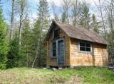
My new House
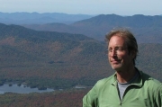
It's Me!
